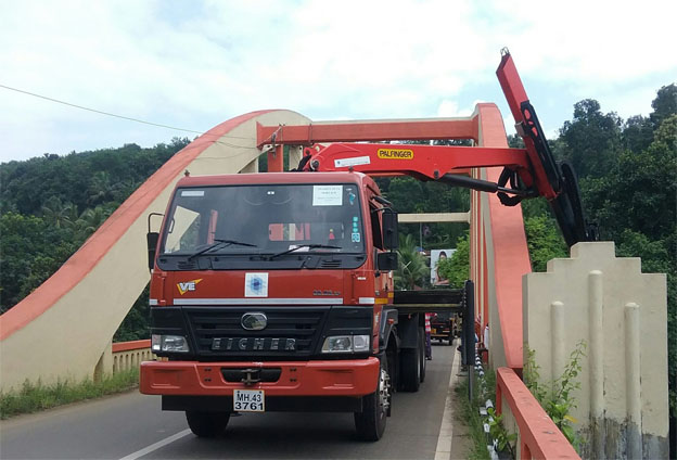
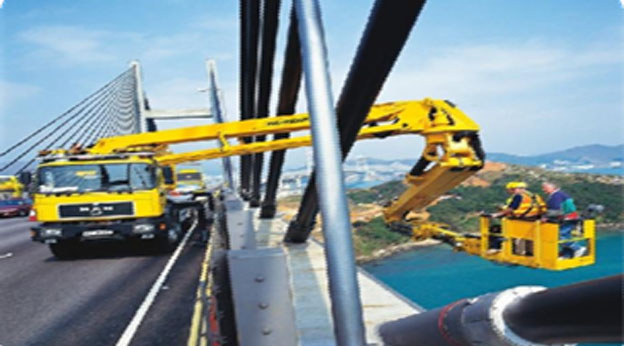
- Mobile Bridge Inspection Unit (MBIU)
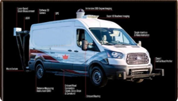
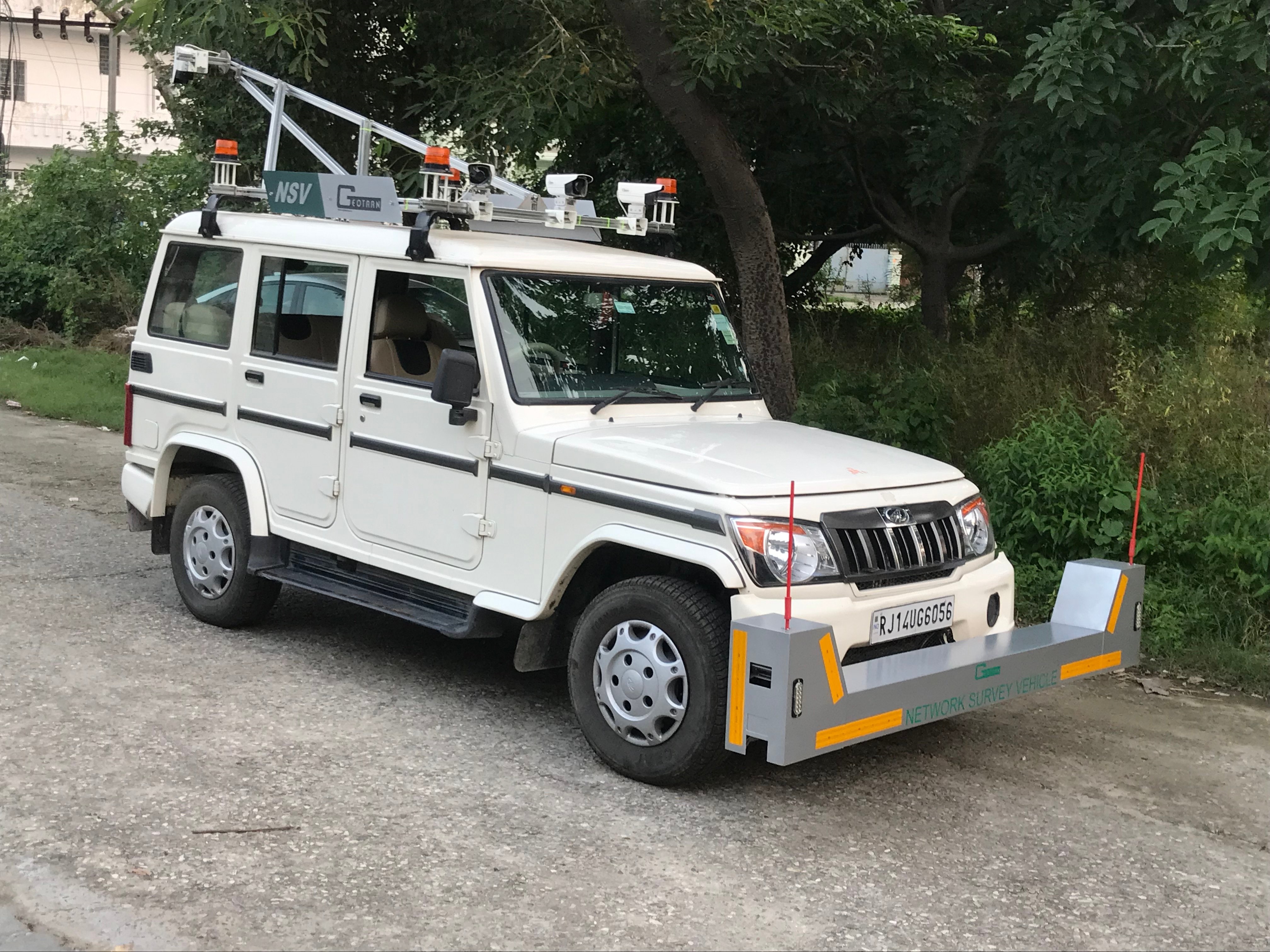
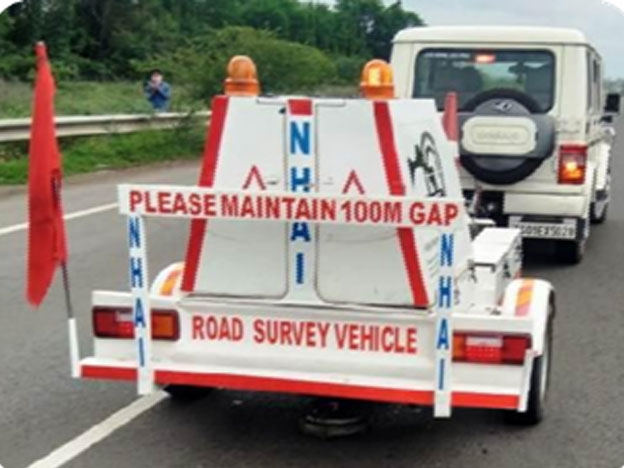
- Network Survey Vehicle (NSV)
- Falling Weight Deflector meter (FWD)
- Retro-Reflectometer (RR)
- Ground penetrating Radar (GPR) and
- Traffic Sampling using Automatic Traffic Counter and Classifier (ATCC)
- Geotechnical investigation
Mobile Bridge Inspection Unit (MBIU)
Used for Bridge condition & Structural Assessment
It contains automatic folding and unfolding platform, 90-degree rotation platform and complete access to hidden parts of the bridge by the raters
Visual Inspection for condition assessment of Bridges as per IRC SP-35, NDT and during repair / and repairing of bridges
Network Survey Vehicle (NSV) using
It is used for functional evaluation of road. Collect Numerous Data Types in a Single Pass:Capable of producing outputs that include data of road distance, dimensions, GPS (DGPS), hi-definition video images, profile and geometry of the road.
Used for Pavement Surface defects determination and Pavement Roughness measurement.
Falling Weight Deflector meter (FWD)
Used for Pavement structural strength assessment
Remaining life of pavement and Overlay thickness
FWD survey shall be carried out as per IRC: 115-2014
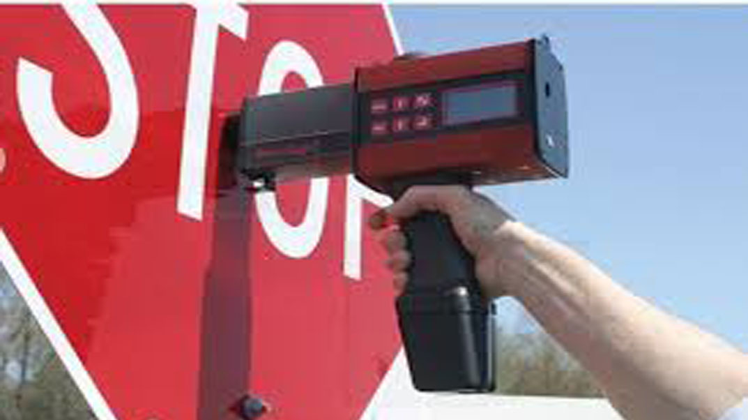
Retro-Reflectometer (RR)
Used for measure the road traffic signs co- efficient of retroreflected luminance (night time retroreflection)
Used to measure the Road markings Retro- reflectivity Dry and Wet, Luminance coefficient, Skid resistance
Built in GPS to capture GPS coordinates of road signs and road markings
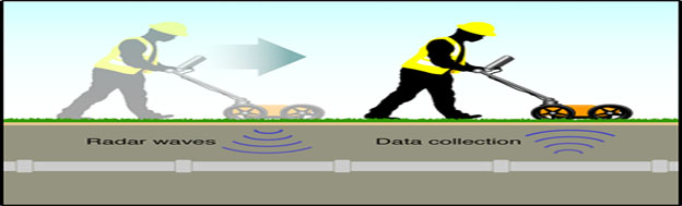
Ground penetrating Radar (GPR)
It is a high-resolution electromagnetic technique that is designed primarily to investigate the underground surface. Used for assessment of Underground Utilities.
It uses high frequency radio waves and transmits into the ground
It identifies live and buried underground utilities and it can be mapped using Autocad and Google earth
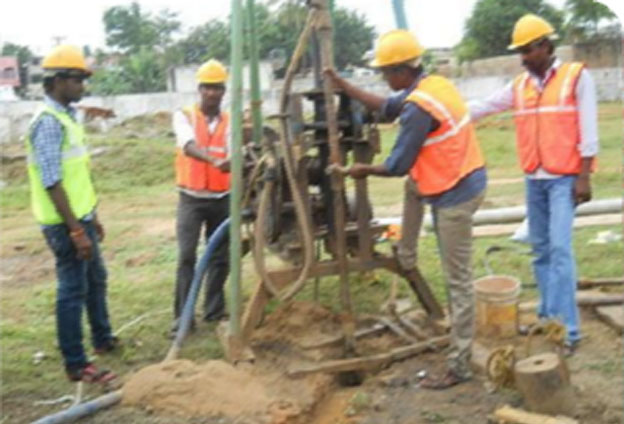
Geotechnical investigation
Geotechnical investigations are performed by geotechnical engineers or engineering geologists to obtain information on the physical properties of soil earthworks and foundations for proposed structures and for repair of distress to sub-soil strata and structures caused by subsurface conditions.